
Ambler Flatwoods
Nature Preserve
Natural Areas: Ambler Flatwoods
State Designated Nature Preserve [#208; 2006]
Perhaps it’s not worth mentioning that flatwoods are – wait for it – forested areas on land with little elevation change. Instead of running downhill, precipitation must move down through the soil column. If the soil isn’t very permeable, this can mean that rainfall remains on the ground for days or even weeks after it falls. And so, flatwoods often support ephemeral ponds that in turn host amphibian populations, moisture-loving ferns, and other species that thrive in wet environments. Some, like mosquitoes, may not enhance your visit.
Ambler Flatwoods is a large preserve that protects more than 500 acres and has a substantial trail system. If there’s been a recent rain, prepare for mud or standing water. Two connected loops explore the area of the preserve that lies west of Meer Road. A large structure that appears associated with an auto salvage operation looms to the south but is far enough away from the trail that it detracts minimally from the experience.
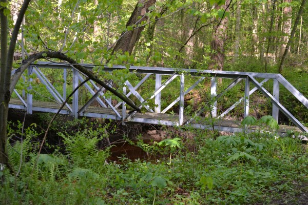
Footbridge. Click to enlarge
USGS maps show lots of wet ground in the area occupied by the main body of the preserve, between Meer Road and 900 North, and my own observations certainly support that. However, I’ve found long portions of the path in this area relatively easy to navigate, even in wet conditions. Perhaps this is a consequence of judicious trail design, some discrete trenching on either side of the path, or subtle differences in drainage. Mature woods and a relatively open understory predominate here.
The northern portion lies north of 900 North and seems disappointing at first. The path runs straight through a rather large pine plantation, and while the tread is pleasant enough there’s not much to see here besides a robust monoculture. Press on. The terminal loop begins at a metal footbridge over a nice stream and has an almost tropical ambiance, at least during the warmer months, with exuberant vegetation everywhere.
I won’t claim that this is my favorite destination in this region, but it definitely has its attractions. It is also far, far larger and more reliably accessible than nearby Wintergreen Woods.
Trail Map
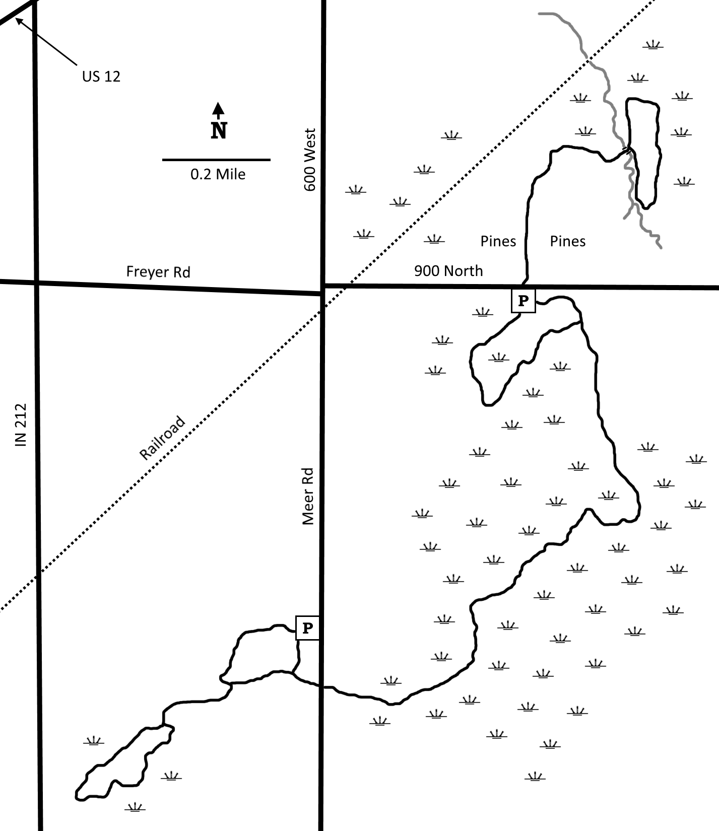
Click to enlarge
Directions
LaPorte County. From US 12 X IN 212, south 0.5 miles on IN 212, then left 0.5 miles on Freyer Road. From there, continue 0.4 miles on 900 N to the north lot on the right, or right 0.6 miles on Meer Road to the south lot on the right.
GPS: N 41 44.287 W 86 48.557 (North)
GPS: N 41 43.073 W 86 48.975 (South)
Facilities
None
Finder Sketch
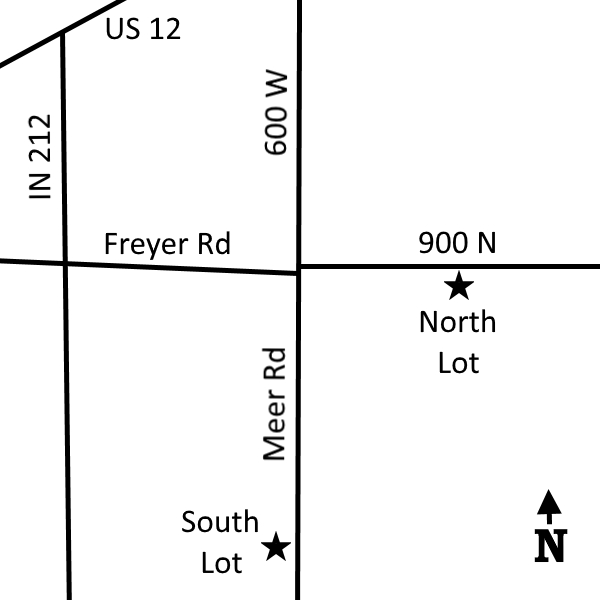
Click to enlarge
Nearby Natural Areas (miles)
Wintergreen Woods (3.3)
Barker Woods (5.9)
Mount Baldy (7.1)
Great Marsh (11.3)
Kemil Beach (13.8)
Luhr County Park (14.3)
Glenwood Dunes Trail (15.7)
Bluhm County Park (16.5)
Spicer Lake Nature Preserve (17.1)
Bendix Woods County Park (19.5)
Indiana Dunes State Park (20)