
Beanblossom Bottoms
Natural Areas: Beanblossom Bottoms
State Designated Nature Preserve [#149; 1995]
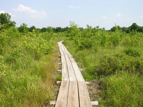
Plank trail, since replaced. Click to enlarge
The initial trail segment follows a graveled lane. Continue straight at the first junction to pass through relatively high ground to a low observation platform with limited views. Turn right at the first junction to follow a truly impressive and slightly elevated platform trail that will usually keep your feet dry while providing opportunities to observe life along the path. Eagles have nested here, and bobcat are present, though you’ll be lucky to see one. I can only imagine how challenging it has been for the Sycamore Land Trust to build and maintain the trail system. I’ve visited this preserve at least a half dozen times and have never failed to find parts of it flooded or closed for construction or repair (hence the incomplete sketch below). I am grateful that they have persevered. The eastern portion may be most susceptible to flooding. I once stood at the terminus wondering what to do when an intrepid family strode up along one of the submerged “trails”, in water up to their knees. Some may wish to visit during drier periods or bring waterproof footgear.
Trail Map
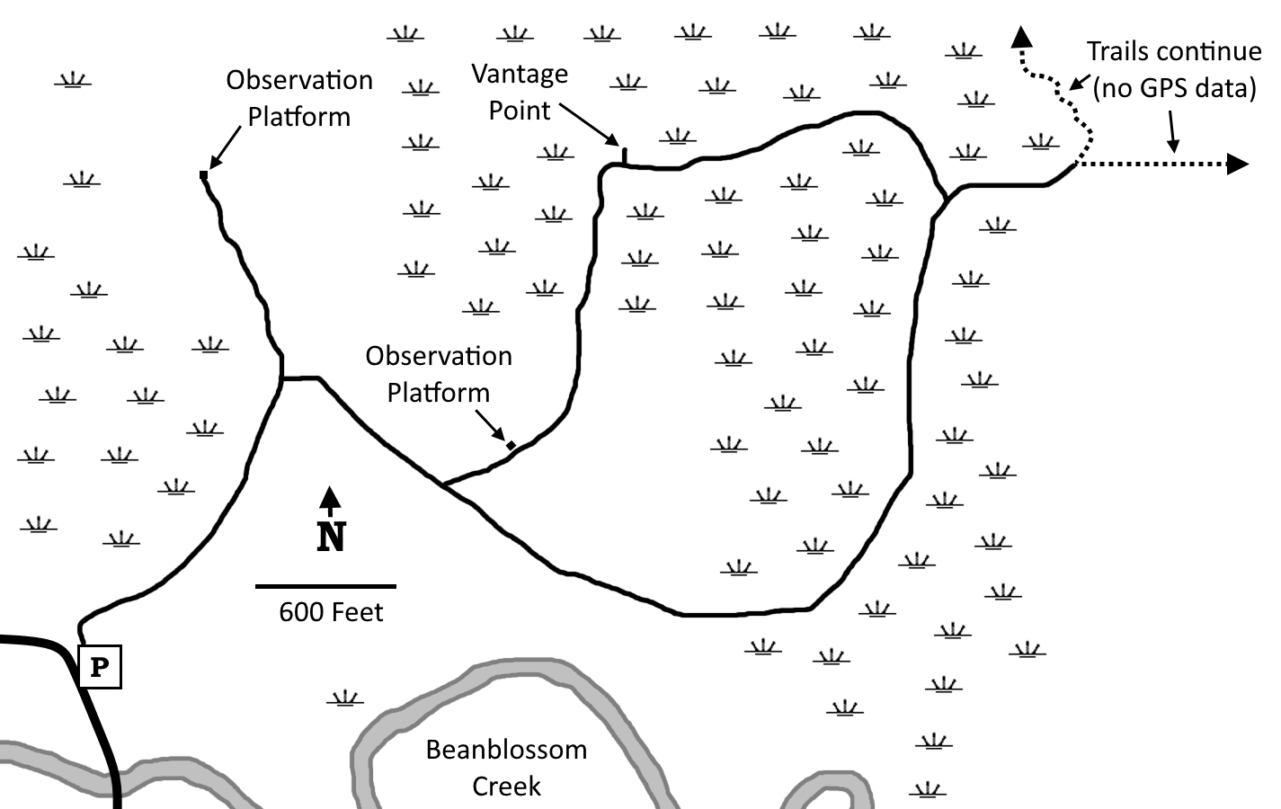
Click to enlarge
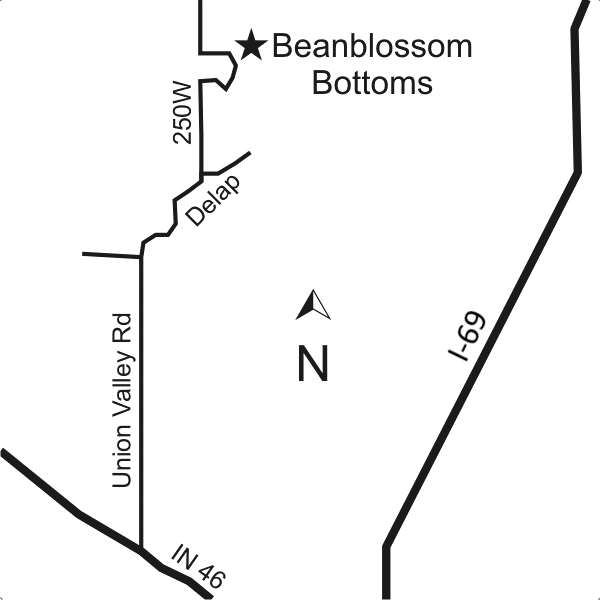
Directions
Monroe County. I-69 X IN 46, west 3.1 miles on IN 46 to Union Valley Rd, then right 2.6 miles to a stop sign, then right 0.9 miles on Delap Road, tending right, to 250 West/Woodall, then left 1.4 miles to the (occasionally submerged) gravel parking area on the right.
GPS: N 39 16.612 W 86 34.713
Facilities
None
Finder Sketch
Click to enlarge
Nearby Natural Areas (miles)
Powell Nature Preserve (6.2)
Porter West Nature Preserve (11.1)
McCormick's Creek State Park (11.3)
Leonard Springs Nature Park (13.8)
Morgan-Monroe State Forest (14.2)
Greens Bluff (14.8)
Scarlet Oak Woods (15.2)
Canyon Forest Nature Preserve (18.6)