
Calli Nature Preserve
Natural Areas: Calli Nature Preserve
State Designated Nature Preserve [#198; 2003]
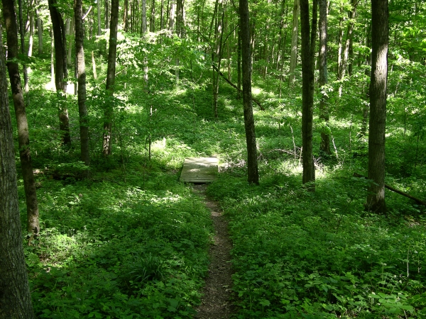
Trail and Footbridge. Click to enlarge
A large figure eight trail explores parts of Calli Nature Preserve, including a substantial stretch along the Muscatatuck River. Bear left from the parking area and you’ll descend into a wooded valley; the thick ground cover includes many kinds of spring wildflowers like twinleaf and Canada violet. As the year progresses, ferns and stinging nettle become more prominent on the forest floor. The trail follows an intermittent stream valley for a while, and you’ll soon encounter a junction. Turning right takes you to the middle of the figure eight.
Continue straight and you’ll emerge at an overlook above the Muscatatuck River, with large oaks overhead. The trail then more-or-less follows the river for a mile or so. It’s a very scenic stretch; in some spots, limestone cliffs rise twenty or thirty feet above the opposite bank and are often undercut by the river. Here and there, large, relatively intact chunks of fallen rock lie partially submerged in the river. There are several hemlock groves along the river; most often on slopes that offer a certain degree of shelter from the sun. Elsewhere, majestic sycamore trees tower over the river, attended by vast oceans of stinging nettle.
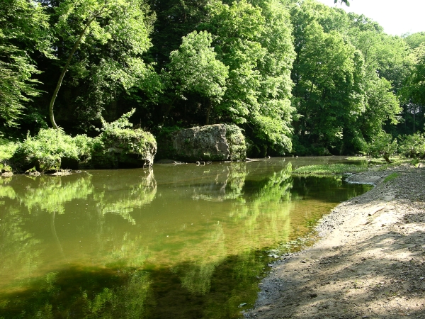
Muscatatuck River. Click to enlarge
The return stretch briefly crosses part of a large meadow before veering left, reentering the woods, and turning sharply right. Again, you’ll find yourself along the river, which the trail follows through another hemlock stand before beginning an ascent until the river is far below to your left. Near the end of the loop, you’ll pass just to the left of an odd tree at station seventeen, the based fused from a red oak and a white oak, with only red oak further up.
Calli is one of the best places I know of to see twinleaf – a spring wildflower whose delicate blossoms rarely last for much more than a day. Each flower is white with eight petals, an inch or more across. In time the plant forms a marvelous cup-like seed pod with a “lid” that pops open when the seeds are ripe and spills them onto the ground.
Because they bloom for such a short time (I usually see them in mid-April) it can be a challenge to see the flowers. You’re far more likely to see the much more persistent leaves, which somewhat mirror each other and barely connect at the stem that supports them.
Trail Map
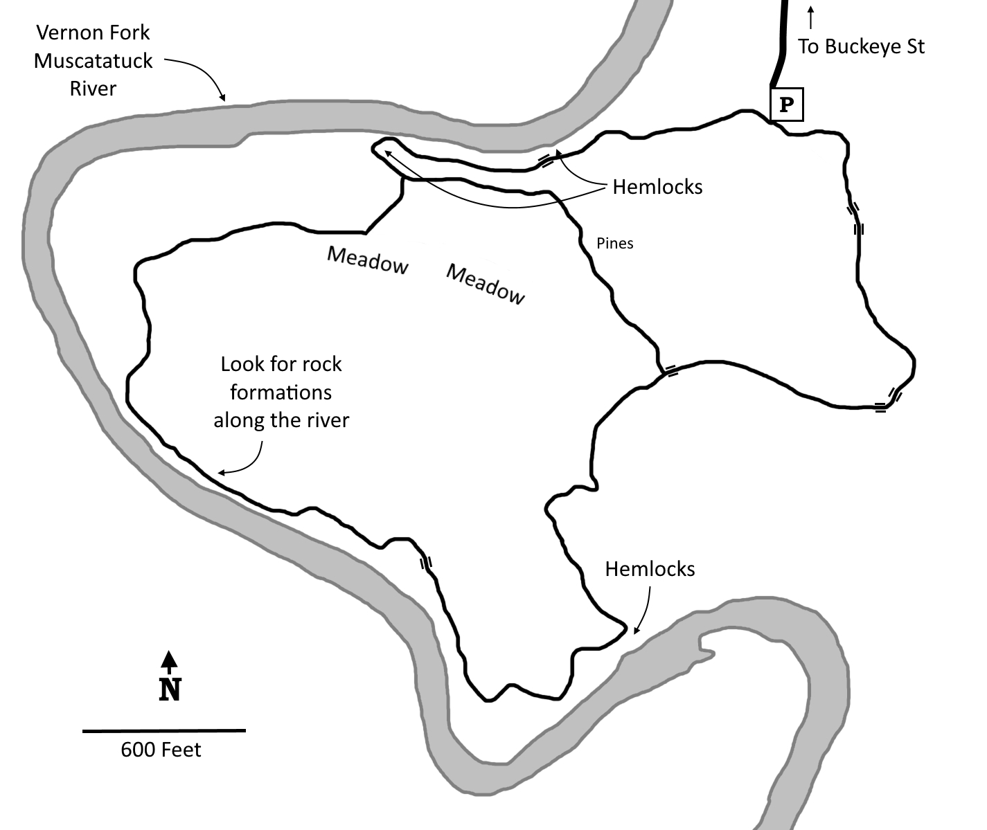
Click to enlarge
Directions
Jennings County. From the US 50 roundabout on the east side of North Vernon, west 0.3 miles on Buckeye, then south 0.3 miles on 40 East to a parking area on the left.
GPS: N 39 00.239 W 85 36.244
Facilities
None
Finder Sketch
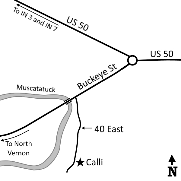
Click to enlarge
Nearby Natural Areas (miles)
Guthrie Woods (10.9)
Muscatatuck National Wildlife Refuge (12.3)
Pennywort Cliffs (18)
Tribbett's Flatwoods Nature Preserve (18.5)