
Clifty Falls State Park
Natural Areas: Clifty Falls State Park
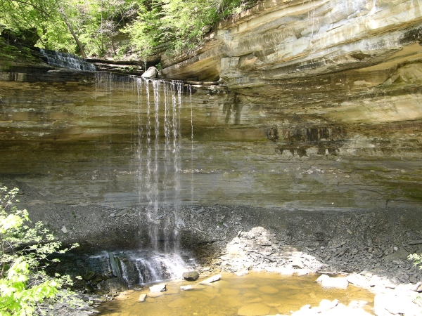
Clifty Falls. Click to enlarge
Park centered on Clifty Canyon Nature Preserve, where several streams converge, many after plunging over high waterfalls, before flowing on toward the Ohio River. The trails in this park are difficult to maintain and closures are frequent; be sure to get a trail map and ask about closures before setting out.
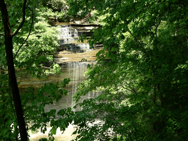
Waterfall. Click to enlarge
Though it has no clearly defined tread, Trail 2 is the premier trail in the park. It goes right up the floor of the canyon, and hikers must work their way upstream across large beds of loose and occasionally slippery rocks arrayed on either side of the creek. The water often casts rocks up along the slower inner stream bank as the creek curves its way along, so that every time the creek changes direction you’ll need to negotiate a crossing to the rocks piled along the other side. This can be a challenge when the water is running high; on the other hand, high water also means the falls are at their most impressive. It’s a rugged scramble of about three miles to the base of Clifty Falls (60’ high); following the eastern branch of the creek takes you to the base of Little Clifty Falls (also 60’ high). Hikers must return along the stream bed to a junction with another trail before climbing out of the canyon.
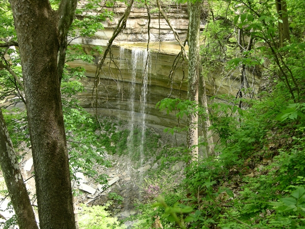
Tunnel Falls. Click to enlarge
Trail 8 runs along the very scenic western rim of the canyon through beech, hickory, maple, and oak trees with abundant spring wildflowers. Trail 5 works its way along the wildflower-encrusted eastern slope of the canyon, partially following the bed of a failed railroad; both entrances of a thousand-foot tunnel are still visible along the trail, and it offers a nice overview of Tunnel Falls (at 83 feet, the highest in the park). Trail 4 features a platform overlooking Hoffman Falls (78’ high). Expect stairs and lots of climbing throughout.
Directions
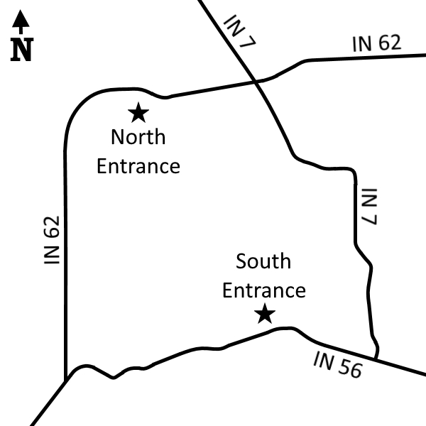
North Entrance:
Jefferson County. From IN 7 X IN 62, west 1.1 miles on IN 62 to entrance on left (south). (Fee)
GPS: N 38 46.253 W 85 26.174
South Entrance:
Jefferson County. From IN 56 X IN 62, east 2.1 miles to entrance on left (north). (Fee)
GPS: N 38 44.531 W 85 24.761
Facilities
Inn, food, campground with showers and toilets, nature center
Finder Sketch
Click to enlarge
Nearby Natural Areas (miles)
Pennywort Cliffs (10.5)
Chelsea Flatwoods (11.3)
Guthrie Woods (14.7)