
Kankakee Sands
Natural Areas: Kankakee Sands
State Designated Nature Preserve [#274; 2016]
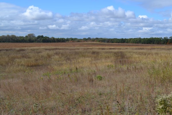
Prairie Vista. Click to enlarge
Kankakee Sands is a vast Nature Conservancy project that encompasses something like 7,000 acres in Indiana and another 1,800 adjacent acres in Illinois. Much of this land was once in agriculture, and the Conservancy has been patiently returning most of it to native plants and restoring the hydrological regime in selected parts, particularly an area that was once part of Beaver Lake, a huge wetland that, until drained in the early part of the 20th Century, was renowned for ducks.
One of the most amazing and wonderful aspects of this project is how it connects many smaller, formerly isolated tracts into an enormous ecosystem, now divided mostly by lightly used county roads. One of those formerly isolated parcels, Beaver Lake Nature Preserve, is a DNR property originally acquired as a last-ditch effort to save Indiana’s last prairie chickens. That didn’t work, but I find it impossible to wander this area now without wondering about an eventual reintroduction of a species that once numbered untold thousands in our state.
In the meantime, the Conservancy states that the complex serves as a home to more than 100 endangered, threatened, or rare species, so there is plenty to see. For example, there is a small bison herd in residence. I haven’t always found them easy to spot or, once found, near enough to see clearly. Look for them anyway!
Your best bet is to stop at the information kiosk adjacent to a small set of headquarters buildings just west of US 41. Maps, checklists, the latest news, and other information are all available here. There are also some short trails, often wet, near the information kiosk. Perhaps the longest trail is the Grace Teninga Discovery Trail. It’s a loop through tall grass that traverses (relatively) high ground and offers vistas of some of the surrounding expanse.
Directions
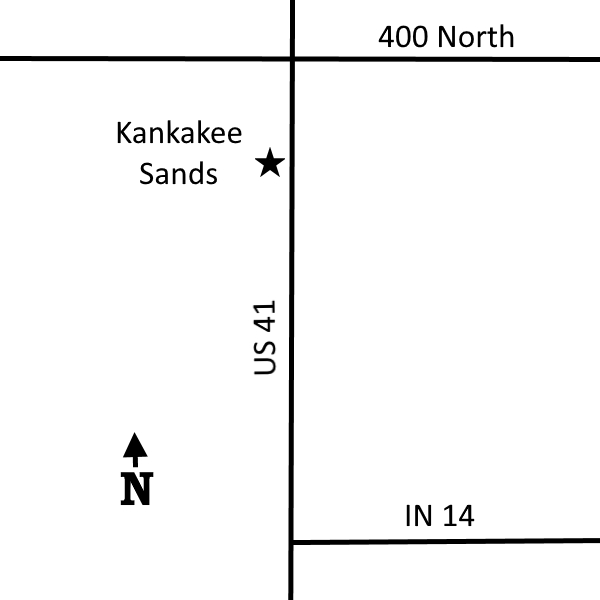
Directions to Headquarters/Information kiosk: Newton County. From US 41 X IN 14, north 2.25 miles on US 41 to the marked entrance on the left (west)
GPS: N 41 02.822 W 87 27.036 (parking)
Directions to Grace Teninga Discovery Trail: From the headquarters, north ľ mile on US 41 to 400 North, then east 1.0 to 200 West, then north 2.0 miles to 600 North, then east 0.7 miles to a parking area on the north side of the road.
Facilities
None
Finder Sketch
Click to enlarge
Nearby Natural Areas (miles)
Conrad Savanna (4.7)
Conrad Station (5.7)