Merry Lea
State Designated Nature Preserve [#58; 1980]

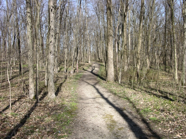
Trail. Click to enlarge
This remarkable place includes eight miles of well-maintained trails that traverse a wide variety of habitats. Goshen College uses it as an environmental learning center, but their students arenít the only beneficiaries. Thousands of area schoolchildren pass through each year, so this is one of the few destinations in this book that may have a lower visitor count on weekends than during the week.
Merry Lea comprises more than a thousand acres. It includes much of the shoreline of Bear Lake, and encompasses numerous wetlands, meadows, and woods; indeed, represented ecosystems include most of those found in northeastern Indiana. The trail network is dense, with many junction points (marked by letters on posts) allowing a variety of routes. Be sure to pick up a trail map at the learning center (stop in if itís open Ė thereís a nice natural history bookstore on the premises) adjacent to the parking lot; the sketch opposite depicts only the central parts of the trail system.

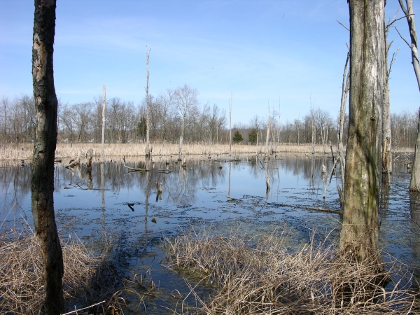
Onion Bottom. Click to enlarge
Thatís because I recommend spending the bulk of your time at Merry Lea in those areas, especially around the Onion Bottom Wetland, which lies only a short stroll to the north of the parking area. Once an onion field, this restored wetland is now full of life. Even the dead trees that rise like skeletons above the waterís surface host woodpeckers (and no doubt many burrowing insects). Trails circle the wetland and short spurs allow closer inspection at several spots. Look for turtles, ducks, dragonflies, the occasional snake, and Canada geese that will insist on noting your presence with extended and noisy commentary.
The path through Bear Lake Prairie offers views of Onion Bottom and Bear Lake, as well as an opportunity to get your feet wet, as the tread is often partially under (shallow) water. Keep an eye out for blue flag iris along this stretch. The Shew Wetlands are nice, and definitely worth checking out Ė who knows what you might see? Trails also extend to the northwest and northeast; the latter area more recently farmed. The land in this part of the property retains some of its agricultural character, along with an old farmstead. Thereís an alternative parking area here, but not much wildness.
Trail Map

Click to enlarge
Directions
Noble County. From US 33 X IN 109 at Wolf Lake, go south 2.2 miles on IN 109, then right 0.9 miles on 350S, then north 0.5 miles on 500W to the marked entrance; continue down the drive to a parking area.
GPS: N 41 18.564 W 85 31.028
Facilities
Learning center
Finder Sketch

Click to enlarge
Nearby Natural Areas (miles)
Crooked Lake Nature Preserve (5.6)
Bender Nature Preserve (7.5)
Dygert Nature Preserve (7.7)
Chain O'Lakes State Park (8.9)
Greider's Woods (11.4)
Spurgeon Woodland Reserve (16.2)
Oppenheim Woods (16.5)
Spring Lake Woods and Bog Nature Preserve (20)
