
Moraine Nature Preserve
Natural Areas: Moraine Nature Preserve
State Designated Nature Preserve [#13; 1971]
Moraine comprises nearly 500 acres and features a sprawling trail network. The best hiking is on the north side of 750 North, where the footpath winds its way through deep woods, crossing rolling topography to the west and flatter terrain to the east. Glacial ponds fill low areas, and wildflowers and spring migrants add color and joyous music to the tableau. Trails to the south of 750 North mostly skirt areas undergoing reforestation, though a stretch along a deep ravine features large trees. Leave the mowed loop under power lines to the west of the parking area for last.
Trail Map
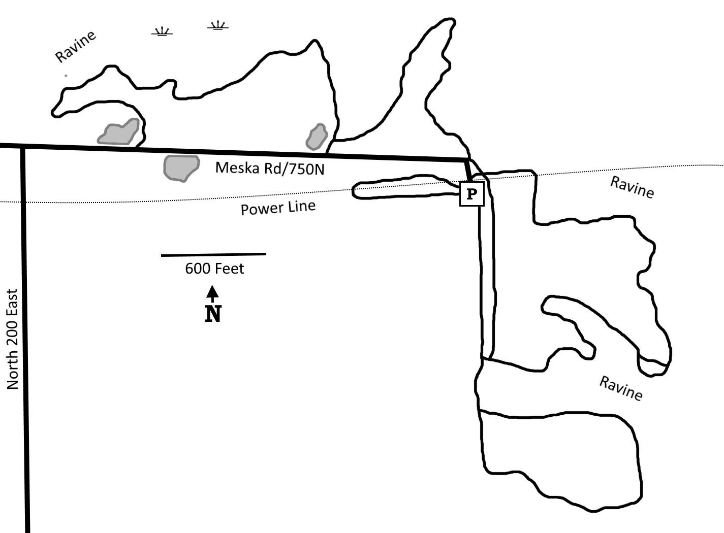
Click to enlarge
Directions
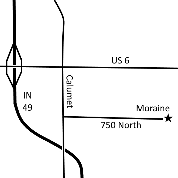
Porter County. From US 6 X IN 49, east 0.5 mile to Calumet, then south 0.5 mile to 750 North. Follow 750 North east about a mile until it ends, where a large parking area is south side of the road.
GPS: N 41 32.533 W 87 01.060
Facilities
None
Finder Sketch
Click to enlarge
Nearby Natural Areas (miles)
Meadowbrook Nature Preserve (4.4)
Bluhm County Park (8.9)
Glenwood Dunes Trail (9.2)
Indiana Dunes State Park (10)
Little Calumet River Trail (10.1)
Cowles Bog (10.6)
Kemil Beach (12.5)
Great Marsh (12.8)
Cressmoor Prairie (13.7)
Tolleston Dunes (14.6)
Coulter Nature Preserve (15.5)
Greiner Nature Preserve (16)
Bur Oak Nature Preserve (16.5)
Mount Baldy (16.8)
West Beach (17.1)
Barker Woods (18.5)