
Mount Baldy
Natural Areas: Mount Baldy
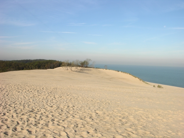
Mount Baldy. Click to enlarge
Mt. Baldy is a living dune, so-called because it moves several feet inland every year. In the process, it buries the vegetation in the path of its advance, and a look at its downwind slope reveals the tops of dead trees sticking forlornly out of the mountain of sand. At some point in the not-too-distant future, it seems likely to bury the parking area and associated facilities. A few years ago, a child fell into a void left by a decayed tree, and access has been somewhat limited since then. There’s a path to the beach, though it’s not certain if it will ever again be possible to enjoy the amazing views once available from the top.
Directions
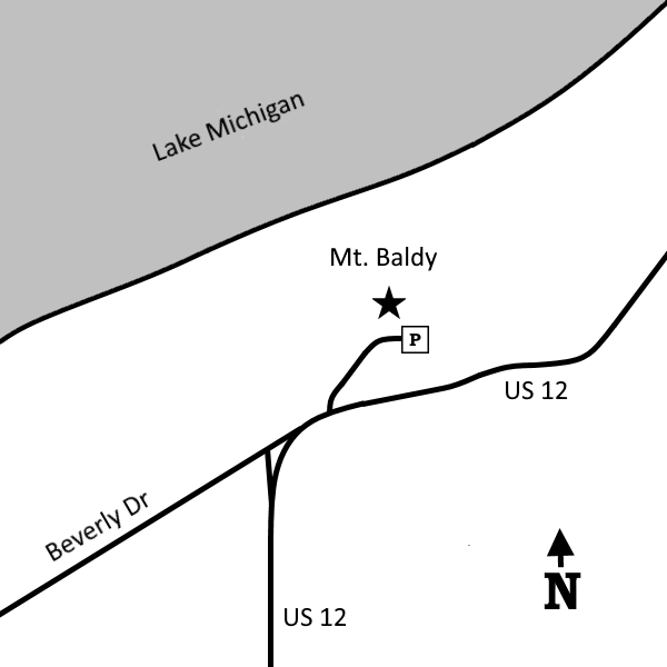
LaPorte County, sandwiched between the county line and Michigan City. North of US 12, just east of the Porter-LaPorte county line.
GPS: N 41 42.417 W 86 55.784 (parking lot)
N 41 42.333 W 86 55.862 (US 12 entrance)
Facilities
Bathrooms with flush toilets
Finder Sketch
Click to enlarge
Nearby Natural Areas (miles)
Great Marsh (4.6)
Barker Woods (5.3)
Ambler Flatwoods (7.1)
Kemil Beach (7.1)
Glenwood Dunes Trail (8)
Wintergreen Woods (9.2)
Indiana Dunes State Park (10)
Cowles Bog (10.7)
Little Calumet River Trail (11.2)
Bluhm County Park (11.9)
Tolleston Dunes (16.2)
Moraine Nature Preserve (16.8)
Meadowbrook Nature Preserve (18.1)
Coulter Nature Preserve (18.3)
Luhr County Park (18.6)
West Beach (18.8)