
Portland Arch Nature Preserve
Natural Areas: Portland Arch Nature Preserve
National Natural Landmark [1973]
State Designated Nature Preserve [#21; 1972]
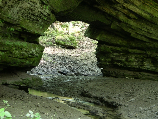
Portland Arch. Click to enlarge
Portland Arch takes its name from a sandstone arch carved by Spring Creek, a small tributary of Bear Creek. While not the largest arch in Indiana, this National Natural Landmark is probably the best known. The property has seen many uses over the years, and building foundations are still visible in places. There are two parking areas and trails, north and south; the arch lies along the former. Brochures are sometimes available at the trail entrances. For formatting reasons, I start with the South Trail, but if you have time for only one, visit the North Trail. The North Trail is where the arch is, and it has by far the better scenery.
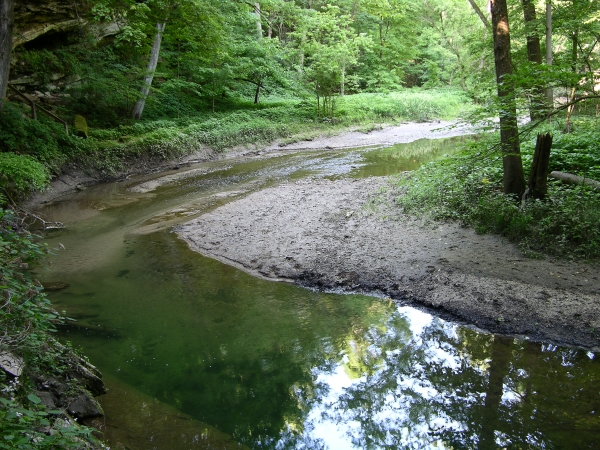
Bear Creek. Click to enlarge
The South Trail explores another section of Bear Creek canyon, passing at times through areas only recently acquired and now reverting to forest. It does not have the same scenic appeal as its companion and receives many fewer visitors. You’ll approach Bear Creek a couple of times, but most of the tread is through woods, including a rather long level stretch like an old railroad bed; look here for fire pink in early summer. After approaching Bear Creek for the second time, the path climbs left and drops into, then quickly climbs out of, another ravine with an intermittent stream. From there, it’s a short walk to the parking area.
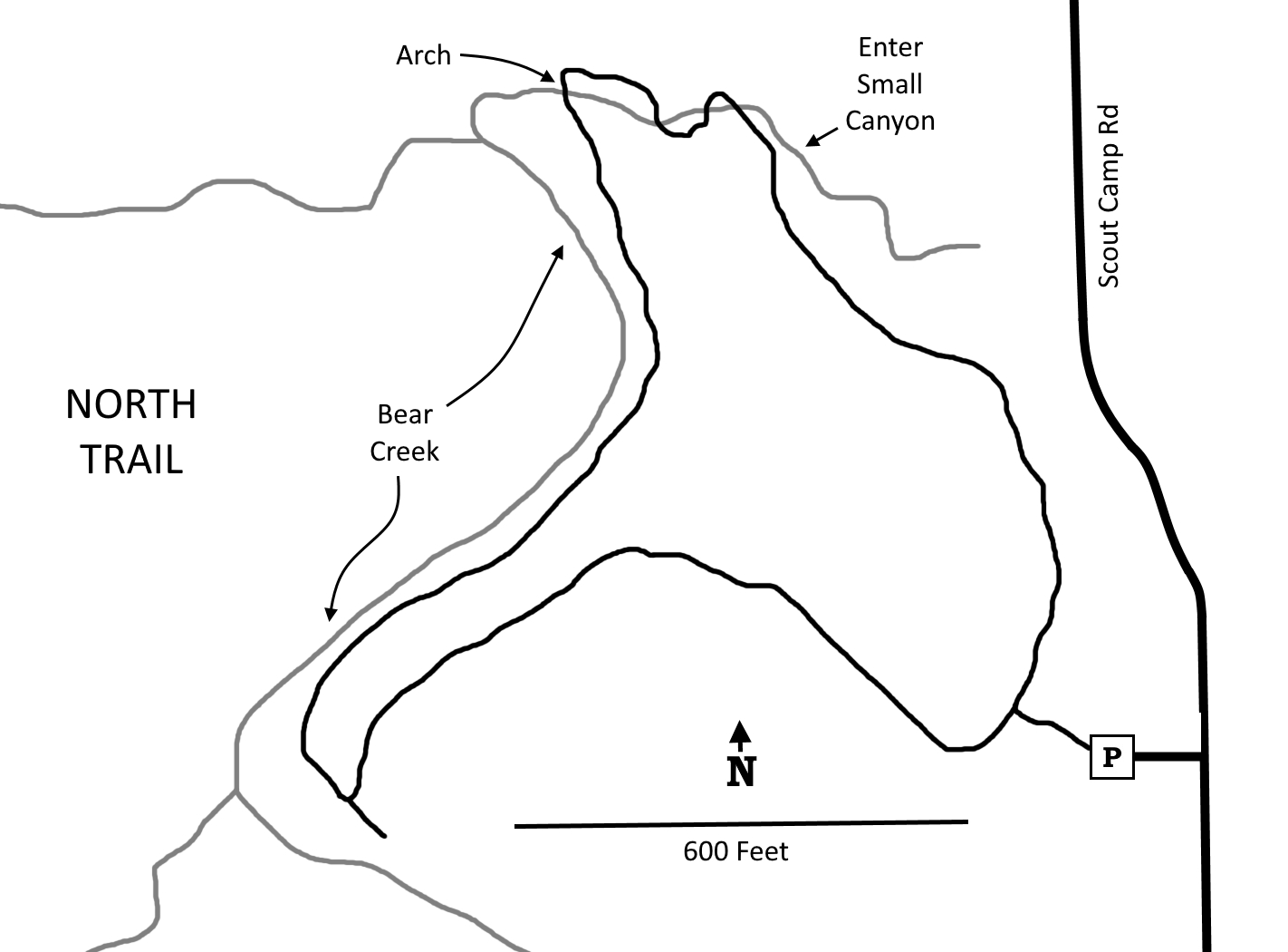
North Trail. A short trail segment connects the main loop with the parking area. Turn right at the first junction. You’ll descend gradually at first, then veer left and descend dramatically into the bottom of the ravine formed by Spring Creek. A cliff face rises to your left, sometimes overhanging the path, while the creek is to your right. Soon Spring Creek takes a sharp left and cuts straight through the cliff face. This is Portland Arch. The arch is tall enough to walk through, and on the other side the trail turns left and begins to follow Bear Creek upstream. Bear Creek Canyon is very scenic. High cliffs tower overhead, first on the left, then the right, then the left again. Fern colonies occupy deep fissures in the rock face. In places the cliffs must be close to a hundred feet above the level of the creek.
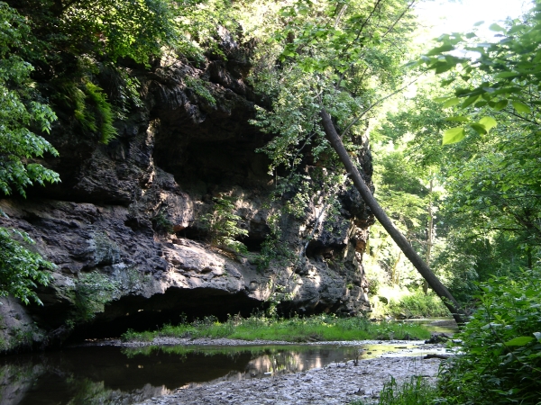
Outcrop. Click to enlarge
Swallows nest in these cliffs, and while they ceaselessly patrol for insects over water that alternately runs swift or backs up in clear quiet pools, mosquitoes still prosper. Eventually the trail makes a hard left toward a cliff. Check the dry sandy soil under rock overhangs for the conical traps of ant lions that metamorphose into improbably beautiful and delicate adults. From here, the path makes another hard left and begins climbing out of the valley, thence back to the parking area.
Trail Map: North Trail
Click to enlarge
Trail Map: South Trail
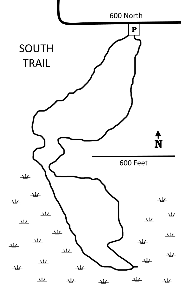
Click to enlarge
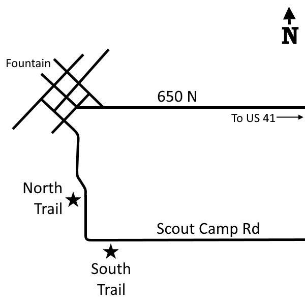
Directions
Fountain County. From I-74 Exit 15, north 6.7 miles on US 41 to CR 650N, then west 4.8 miles to Walnut Street in Fountain. Left one block on Walnut, then left again onto Clay/Scout Camp Rd. The entrance to the parking area for the north trail is 1/3 mile on the right. The parking area for the south trail is a quarter mile beyond that for the north trail, also on the right.
GPS: N 40 12.985 W 87 19.987 (North Trail)
GPS: N 40 12.866 W 87 19.856 (South Trail)
Facilities
None
Finder Sketch
Click to enlarge
Nearby Natural Areas (miles)
Shawnee Bottoms (1.8)
Rock Creek Nature Preserve (10.1)
Smith Cemetery Nature Preserve (18.4)