
Brown County State Park
Natural Areas: Brown County State Park
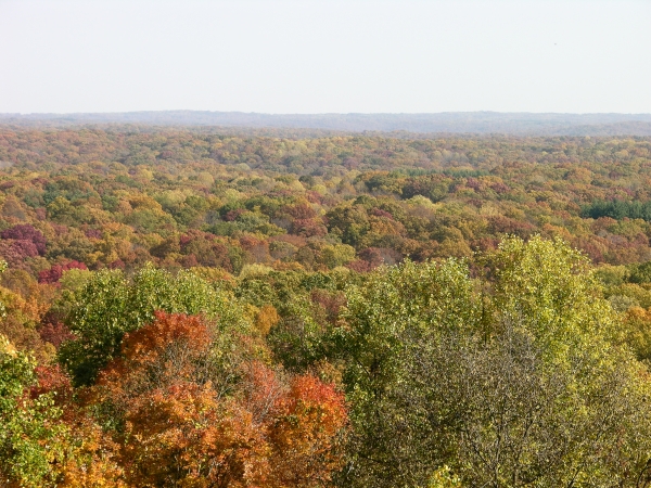
Autumn Vista. Click to enlarge
Brown County State Park is famous for fall foliage. If you are there on the right autumn day, your route will take you through leafy tunnels festooned with gaudy reds, yellows, and orange, and past vistas that stretch for miles over the hills of southern Indiana. However, you won’t be alone. Ponderous motor homes and other vehicles will clog the narrow roads that wind along ridge tops, and the ravines that drop dramatically on either side will reverberate with the deliberately amplified roar of motorcycle engines. If your tolerance for crowds and noise is low, visit at some other time. But you really should visit.
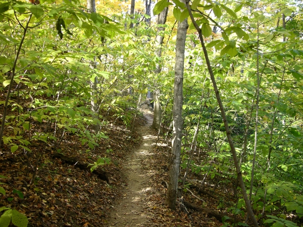
Ogle Hollow. Click to enlarge
At more than 15,000 acres, Brown County is by far the largest park in the state and offers many hiking trails. Few will disappoint. If you have the time, I recommend a route that incorporates three of those paths. Trail 5 begins at a small parking lot near the Rally Campground entrance, then quickly descends a short flight of stairs into the Ogle Hollow Nature Preserve. Its forty-one acres protect a stand of state-endangered yellowwood trees. A nice stand of extremely tall pawpaw trees also benefits. The trail descends steeply before reaching bottom and looping back into the upper reaches of the ravine.
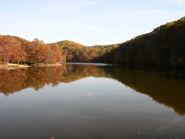
Ogle Lake. Click to enlarge
Trail 5 connects to Trail 4 in the ravine bottom; follow it east, watching carefully for squaw root in late spring. You’ll soon reach Trail 7, which loops Ogle Lake, a 17-acre impoundment that nestles jewel-like among the wooded hillsides. There are ruts in the path from heavy use, but the attractive setting explains why. Complete the loop and return via Trail 4 and the Ogle Hollow Nature Preserve.
Directions
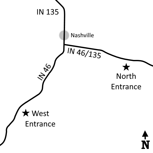
Brown County. West gate is off IN 46, 2.3 miles southwest of the IN 46 X IN 135 intersection. North gate is off IN 46, 1.7 miles east of the same intersection. (Fee)
North Gate GPS: N 39 11.831 W 86 12.982
West Gate GPS: N 39 10.604 W 86 16.226
Facilities
Inn, camping, nature center, many other amenities.
Finder Sketch
Click to enlarge
Nearby Natural Areas (miles)
Hitz-Rhodehamel Woods (6.3)
Yellowwood State Forest (10.7)
Tangeman Nature Preserve (11)
Selma Steele Nature Preserve (11.7)
Touch the Earth Natural Area (11.8)
Hare Preserve at Downey Hill (16)
Scarlet Oak Woods (16.8)