
Morgan-Monroe State Forest
Natural Areas: Morgan-Monroe State Forest
Bryant Creek Lake. Click to enlarge
Morgan Monroe State Forest contains more than twenty-three thousand acres of wooded hills and ravines. The forest is home to wild turkey, ruffed grouse (though greatly diminished populations), pileated woodpeckers, and many kinds of wildflowers. It is also a less crowded alternative to Brown County State Park during the autumn leaf viewing season, though DNR permits hunting on the property during specified times. It also has a state-dedicated nature preserve and many hiking trails.
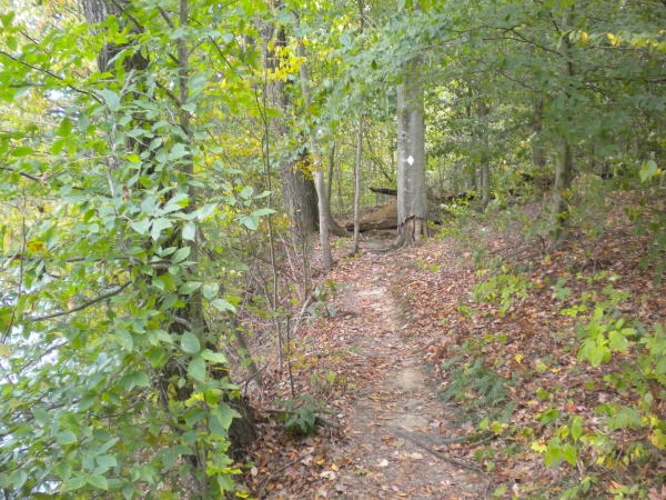
The Low Gap Trail (N 39 18.661 W 86 25.476) is a ten-mile loop; it extends east into a backcountry area where DNR allows camping. There is a fair amount of walking along gravel roads and ridge lines, but also some scenic stretches and a few stiff climbs. I recommend hiking this trail backwards to get most of the road walking out of the way first. The Rock Shelter Trail is a three-mile sub-loop of the Low Gap Trail that passes by interesting rock formations in Sweedy Hollow.
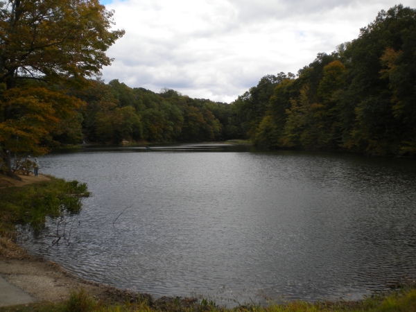
Three Lakes Trail. Click to enlarge
The Three Lakes Trail (N 39 19.333 W 86 25.407; now misnamed since a 1993 levee failure drained Beanblossom Lake) is a loop of just over ten miles. It starts and ends near Cherry Lake, and follows a roughly triangular path, with a lake (or former lake) at each vertex. The trail lies to the west and south of the forest headquarters. Though the tread is relatively flat along ridge lines or stream valleys, expect numerous climbs and descents, particularly as you cross from one ridge to another.
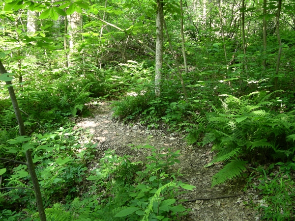
Scout Ridge Nature Preserve. Click to enlarge
Scout Ridge Nature Preserve (Trailhead: N 39 19.762 W 86 24.914) is adjacent to the Youth Campground. A two-mile loop begins behind the shelter house, descends to follow the course of an intermittent stream through a scenic valley, and then returns past large beech trees. The Illinois glacier stopped here 100,000+ years ago.
There are several other trails. The Tree Identification Trail is an easy one-mile loop that starts near the forest headquarters. The Mason Ridge Trail (about three miles) shadows the main forest road and shares about half its tread with the Low Gap Trail. Morgan-Monroe State Forest is also the northern terminus of the Tecumseh Trail, a forty-two mile link to Brown County State Park that hiking advocates hope will someday comprise the northern third of the greater Knobstone Trail.
Directions
Morgan County and Monroe County. From I-69 Exit 134, east on Liberty Church Rd, then immediately right on Hacker Creek Rd, then tend right onto Old State Road 37. Continue about 3.8 miles to the forest entrance on the left.
GPS: N 39 19.620 W 86 28.340
Facilities
Water, shelter houses, pit toilets, primitive camping
Finder Sketch
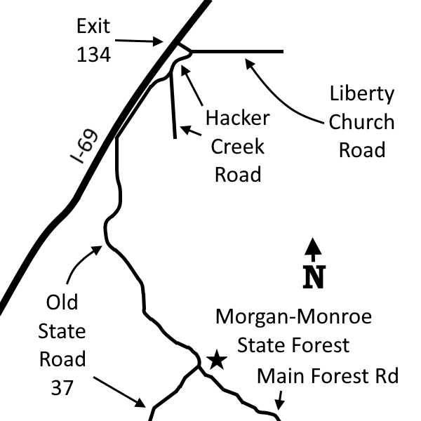
Click to enlarge
Nearby Natural Areas (miles)
Scarlet Oak Woods (12.8)
Beanblossom Bottoms (14.2)
Yellowwood State Forest (16.8)
Hare Preserve at Downey Hill (17.7)
Hitz-Rhodehamel Woods (17.7)
Powell Nature Preserve (18.5)