Indiana's National
Natural Landmarks
EcoIndiana: National Natural Landmarks
According to the National Park Service, "The National Natural Landmarks Program recognizes and encourages the conservation of sites that contain outstanding biological and geological resources. Sites are designated by the Secretary of the Interior for their condition, illustrative character, rarity, diversity, and value to science and education. The National Park Service administers the program and works cooperatively with landowners, managers and partners to promote conservation and appreciation of our nation's natural heritage."
Indiana has at least 30 National Natural Landmarks. Some are open to the public and others are not.
Big Walnut Creek
Putnam County. 450 acres. Designated in 1968.
National Park Service Description: Big Walnut Creek is a branch of the Eel River formed as a result of glacial melt and postglacial water erosion. The site contains one of the few stands in Indiana where beech, sugar maple, and tulip poplar grow on alluvial Genesee soil and includes relict species of a postglacial forest that occupied the area 5,000 to 6,000 years ago.
Note: A portion of this property is called Fortune Woods.
Cabin Creek Raised Bog
Randolph County. 80 acres. Designated in 1974.
National Park Service Description: Elevated some 10 feet above the general flood plain level of Cabin Creek, Cabin Creek Raised Bog is a fen (alkaline bog) that supports a very rich flora, including many species at or near their range limits.
Calvert & Porter Woods
Montgomery County. 40 acres. Designated in 1974.
National Park Service Description: Calvert and Porter Woods Nature Preserve contains one of the finest near-virgin remnant forests in the Tipton Till Plain of central Indiana. The site contains a great diversity of tree species due to a pronounced moisture gradient producing different habitats, and a great blue heron rookery.
Porter County. 22 acres. Designated in 1965.
National Park Service Description: Cowles Bog illustrates marsh and bog habitat, as well as transition to swamp. Located within Indiana Dunes National Park, the site includes flora that are locally rare.
Davis-Purdue Ag Center Forest
Randolph County. 48 acres. Designated in 1974.
National Park Service Description: The Davis-Purdue Agricultural Center Forest is the best old growth oak-hickory forest on the Tipton Till Plain and possibly one of the finest such forests in the eastern United States. The site contains exceptionally large individuals of several tree species.
Donaldson Cave System & Woods
Lawrence County. 220 acres. Designated in 1972.
Note: Contained within Spring Mill State Park.
National Park Service Description: Located within Spring Mill State Park, Donaldson Cave System and Woods is a tract containing 80 acres of prime virgin forest and a cave system associated with the Indiana karst region. Donaldson Cave includes three separate units that are interconnected by underground passageways.
Dunes Nature Preserve
Porter County. 1,578 acres. Designated in 1974.
Note: Contained within Indiana Dunes State Park.
National Park Service Description: The Dunes Nature Preserve, located within Indiana Dunes State Park, is the best remaining example of undeveloped and relatively unspoiled dune landscape along the southern shore of Lake Michigan, a portion of which is known as the "Birthplace of American Ecology." The site also contains the Ancient Pines Nature Area, a prehistoric forest now exposed by dune blowouts.
Putnam County. 43 acres. Designated in 1980.
|
National Park Service Description: Fern Cliff contains exceptional occurrences of mosses and liverworts, including a noteworthy number of rare species. The site is one of the best areas for bryophytes in the central states. |
Ferns on part of the cliff face. Click to enlarge |

Wabash County. 2 acres. Designated in 1986.
|
National Park Service Description: Hanging Rock and Wabash Reef consists of two, one-acre sites along the south bank of the Wabash River. Both contain natural exposures of limestone reef deposits characteristic of Silurian rocks of the midwestern United States, most of which are exposed only in quarries. Hanging Rock is an impressive natural exposure of an exhumed reef that rises 75 feet above the Wabash River. Wabash Reef, one of the best known fossil reefs in the world, has been the subject of numerous studies responsible for the development of modern reef theory. |
Wabash River view from atop Hanging Rock. Click to enlarge |

Harrison Spring
Harrison County. 7 acres. Designated in 1980.
National Park Service Description: The largest spring in Indiana, Harrison Spring is one of the best examples of alluviated cave springs in the United States due to its location in an abandoned meander loop, and the natural levee around its periphery.
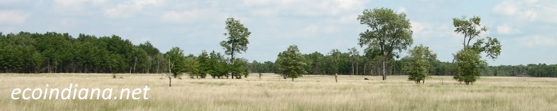
Gibson County. 86 acres. Designated in 1973.
National Park Service Description: Illustrating the transition from lowland to upland forest, Hemmer Woods contains one of the best mixed lowland stands remaining in Indiana, the largest known specimens of tulip tree in the state, and a great abundance of wildflowers.
Lake County. 330 acres. Designated in 1974.
National Park Service Description: Hoosier Prairie is the last large tract of prairie near the eastern margin of the "Prairie Peninsula." The site contains a great diversity of community types, with nearly 300 vascular plant species identified here.
Hoot Woods
Owen County. 85 acres. Designated in 1973.
National Park Service Description: Hoot Woods is a relatively undisturbed, isolated beech-maple forest in which near climax conditions prevail.
Kramer Woods
Spencer County. 233 acres. Designated in 1973.
National Park Service Description: Kramer Woods is the only example of a Shumard's red oak-pin oak-hickory dominated stand of lowland mixed forest of any size in Indiana.
Marengo Cave
Crawford County. 7 acres. Designated in 1984.
National Park Service Description: A textbook example of a cave in its middle stage of development, Marengo Cave is the most profusely decorated cave known in the Interior Lowlands biophysiographic province, with cave features of the highest quality. The cave is the location where five organisms were first identified and has had an extensive and continuous history of research and protective custody over the last century.
Shelby County. 44 acres. Designated in 1973.
National Park Service Description: A pre-settlement forest now in dynamic equilibrium, Meltzer Woods contains a juxtaposition of two contrasting forest types (beech-maple and lowland mixed forests) and exceptionally large individuals of several tree species.
Officer's Woods
Jefferson County. 152 acres. Designated in 1974.
National Park Service Description: Officer�s Woods is one of the finest remnants of beech-maple forest south of the Wisconsin-age glacial boundary in Indiana. The site contains two stands with slightly different composition, one of which contains an exceptionally high density of black gum.
Ohio Coral Reef
Clark County. 677 acres. Designated in 1966.
National Park Service Description: Within the Ohio River, the Ohio Coral Reef is a classic example of a Silurian and Devonian coral community. The site is the type locality for a number of coral species and nearly 900 nominal species have been founded on specimens collected here.
Montgomery County. 467 acres. Designated in 1968.
National Park Service Description: Sharply dissected by deep, stream-carved canyons that have left narrow rock ridges or backbones, the Pine Hills Natural Area is probably the most remarkable example of incised meanders in the eastern United States. The site contains a variety of habitats and a number of plant species considered to be Pleistocene relicts.
Pinhook Bog
LaPorte County. 23 acres. Designated in 1965.
National Park Service Description: Pinhook Bog is a living demonstration of the textbook description of ecological succession from pond to woodland. Located within Indiana Dunes National Park, the site lies within a bowl-shaped depression likely to be a glacial kettle, and is surrounded by wooded hills.
Pioneer Mothers Memorial Forest
Orange County. 92 acres. Designated in 1974.
National Park Service Description: Pioneer Mothers Memorial Forest, located within Wayne-Hoosier National Forest, is one of the best examples of an original, undisturbed pre-settlement forest in Indiana. The site contains the finest examples of forest-grown walnut trees in the United States.
Fountain County. 181 acres. Designated in 1973.
|
National Park Service Description: Portland Arch Nature Preserve contains massive crossbedded sandstone cliffs and a seven-foot high natural bridge. The site has many plant species unknown elsewhere in Indiana, some of which are relicts due to the unusual climate created by the canyon. |
The Arch. Click to enlarge |

Rise at Orangeville
Orange County. 4 acres. Designated in 1972.
National Park Service Description: The Rise at Orangeville is the second largest spring in Indiana and the clearest illustration of subterranean stream resurgence in the famed Lost River karst area.
Rocky Hollow Falls Canyon Nature Preserve
Parke County. 370 acres. Designated in 1974.
National Park Service Description: Rocky Hollow-Falls Canyon Nature Preserve, located within Turkey Run State Park, contains forested areas of virgin beech-maple stands, steep sandstone gorges that harbor virgin boreal relict populations of eastern hemlock and Canada yew, and some of the largest black walnut in the Midwest.
Note: Contained within Turkey Run State Park.
Fayette County. 27 acres. Designated in 1974.
National Park Service Description: An outstanding pre-settlement beech-maple forest, Shrader-Weaver Woods contains unusually large trees, such as a 56-inch diameter burr oak and a 34-inch diameter black maple.
Tamarack Bog
Lagrange County. 140 acres. Designated in 1973.
National Park Service Description: Tamarack Bog Nature Preserve, located within Pigeon River State Game Preserve, contains the largest, well-developed tamarack swamp-bog forest in Indiana. The site supports six distinct vegetation types and more than 34 mammal species.
Tolliver Swallowhole
Orange County. 17 acres. Designated in 1972.
National Park Service Description: Tolliver Swallowhole is an extraordinary example of the disappearing stream aspect of karst topography. The site contains an elongated channel with a small opening at the bottom of the west end of the channel that opens into a segment of the Lost River underground.
Wesley Chapel Gulf
Orange County. 33 acres. Designated in 1972.
National Park Service Description: Probably the largest sinkhole in Indiana, Wesley Chapel Gulf is the most significant and spectacular feature of the Lost River Basin, one of the world's great karst areas. Located within the Hoosier National Forest, the site is a classic illustration of a uvula, a feature formed by the coalescence of a series of sinkholes.
Vanderburgh County. 182 acres. Designated in 1973.
National Park Service Description: Wesselman Park Woods is one of the finest remaining large tracts of pre-settlement lowland mixed forest in Indiana. The site contains a number of exceptionally large trees and is unusual in that sweet gum and tulip tree are the dominant species.
Wyandotte Caves
Crawford County. 98 acres. Designated in 1972.
National Park Service Description: Wyandotte Cave, located within O'Bannon Woods State Park, has 23 miles of explored passageways, vertical relief encompassing several levels, huge rooms, gigantic domepits, rubble breakdown and stalagmites. It is one of the great cave systems within the karst region of the east-central United States.