Southern Wabash Lowlands Ecoregion
Ecoregions: Southern Wabash Lowlands
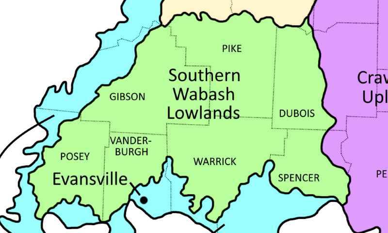
Southern Wabash Lowlands Ecoregion shown in tan
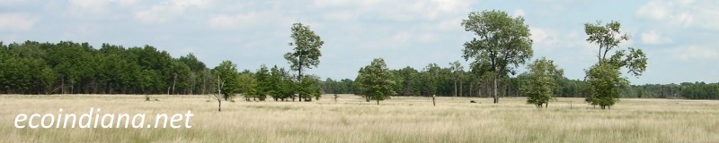
The Southern Wabash Lowlands ecoregion is undulating to rolling and has many wide, shallow valleys. Pre-Wisconsinan (that is, greater than 110,000 years ago) till plain; relict dunes and wind-blown silt deposits occur in the west, and shale and sandstone bedrock is exposed in the east. Originally, oak-hickory forests grew on the well-drained upland soils while western mesophytic forests (diverse, oak-dominated forests) occurred on more poorly-drained soils; some southern plants reached their northern distributional limits here. Source: US EPA
Natural Areas in this ecoregion include:
Columbia Mine (Pike County)
Hemmer Woods (Gibson County)
Lincoln State Park (Spencer County)
Thank you for visiting ecoindiana.net. I hope you find it useful.
Mike Habeck