
Porter County
Counties: Porter County
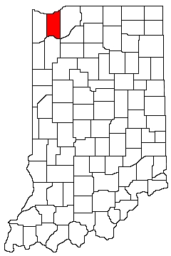
Porter County is in northwest Indiana. It is bounded on the north by Lake Michigan, on the west by Lake County, on the south by Jasper County, and on the east by LaPorte County.
Natural Areas
Coulter Nature Preserve
See also: Heinze ·
DNR [PDF]
Cowles Bog
See also: NPS
Dunes Nature Preserve
DNR [PDF]
Dunes Prairie Nature Preserve
DNR [PDF]
Engquist Nature Preserve
Heinze
Glenwood Dunes Trail
Formerly Ly-co-ki-we Trail
See also: NPS
Great Marsh Trail
See also: NPS
Great Marsh (Beverly Shores)
Heinze
Heron Rookery Trail
NPS
Indiana Dunes State Park
See also: DNR
JD Marshall Nature Preserve
DNR [PDF]
Kemil Beach
See also: NPS
Little Calumet River Trail
See also: NPS
Meadowbrook Nature Preserve
See also: Heinze
Moraine Nature Preserve
See also: DNR [PDF] ·
NC
Ritchie Nature Preserve
Heinze
Pinhook Bog Trails
NPS
Tolleston Dunes
Formerly Inland Marsh
See also: NPS
Walner Nature Preserve
Heinze
Walnut Woods
Heinze
West Beach
See also: NPS
Wykes-Plampin Nature Preserve
Heinze
Organizations
Indiana Native Plant Society - North Chapter
Watersheds
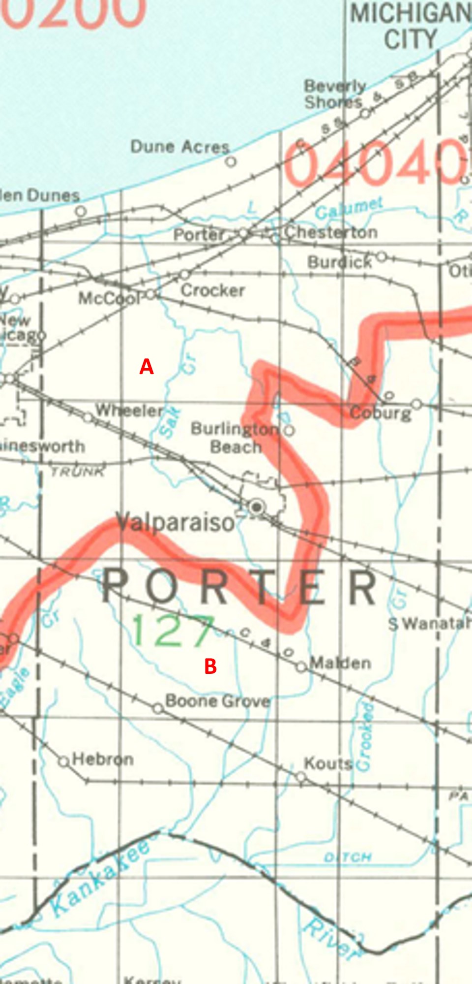
Porter County Watersheds
Click to enlarge
Red lines on the map depict the boundaries of 8-digit hydrologic units (one convenient definition of a watershed) as shown on this 1974 United States Geological Survey Map.
Porter County drains into two different 8-digit hydrologic units, each represented on the image above by an area between red lines and within the county boundary, designated by a letter. Clicking on a watershed name below will take you to separate page with more information on that watershed.
Letter |
Watershed |
A |