
Cowles Bog
Natural Areas: Cowles Bog
National Natural Landmark [1965]
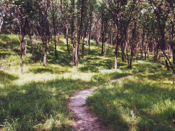
Path through inland side of dunes. Click to enlarge
A favorite destination, this National Natural Landmark has historical significance on top of being a great place to hike and explore. The name honors Dr. Henry Cowles (pronounced Coles) of the University of Chicago; his field work in this area was important in the development of the science of ecology.
There are two parking areas, but I recommend using the one closest to the entrance to Dune Acres. After parking, retrace your path along the one-lane dirt road and cross the Dune Acres entrance road. The trail sticks to the northern edge of a wetland, occasionally crossing wet areas on boardwalks. In warm weather ferns are everywhere, snakes are likely, and mosquitoes are certain. At the first junction turn right and climb into a savanna-like area (image, next page) on the lee side of the dunes. Continue bearing right at intersections; you will eventually hear the lake, and then on topping a final dune see the beach below and the lake stretching to the horizon.
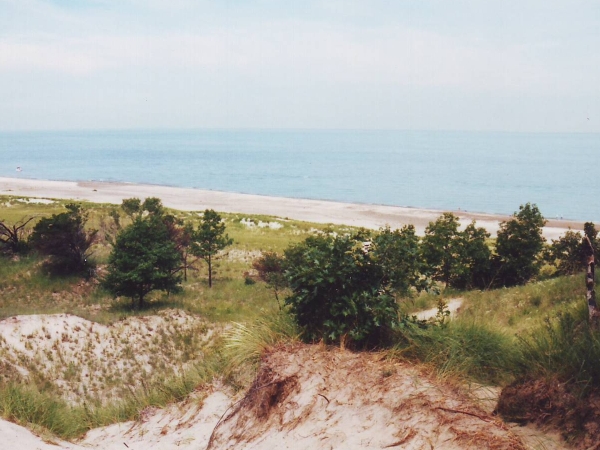
View from Top of Dune. Click to enlarge
The descent to the beach is sandy and steep; remember that you will need to climb back up and out when you are ready to leave. You’ll pass marram grass in the foredunes, an important plant whose roots do much to hold dunes in place. Cottonwood trees survive relatively close to the beach. As sand piles up around them, buried branches turn into roots, and the plant continues to grow. Look for sea rocket, cocklebur, and bugseed as you make your way west along the beach.
The western path away from the beach is not terribly obvious; look for footprints at a break in the dune. After climbing up from the beach, you will top the dune and descend somewhat, traversing again the same savanna-like habitat that you walked through on your way to the beach. In the process, you’ll top several smaller rises. An immense steelworks is occasionally visible just to the west.
It’s possible and sometimes interesting to return to the south trail head and then, if you’ve parked your vehicle at the north lot, walk along Mineral Springs Road back to your car (see sketch, opposite). I prefer to turn left in the south-central portion of the preserve and return via the path I entered on. The return trip offers a different perspective, and often reveals things initially unseen.
Trail Map
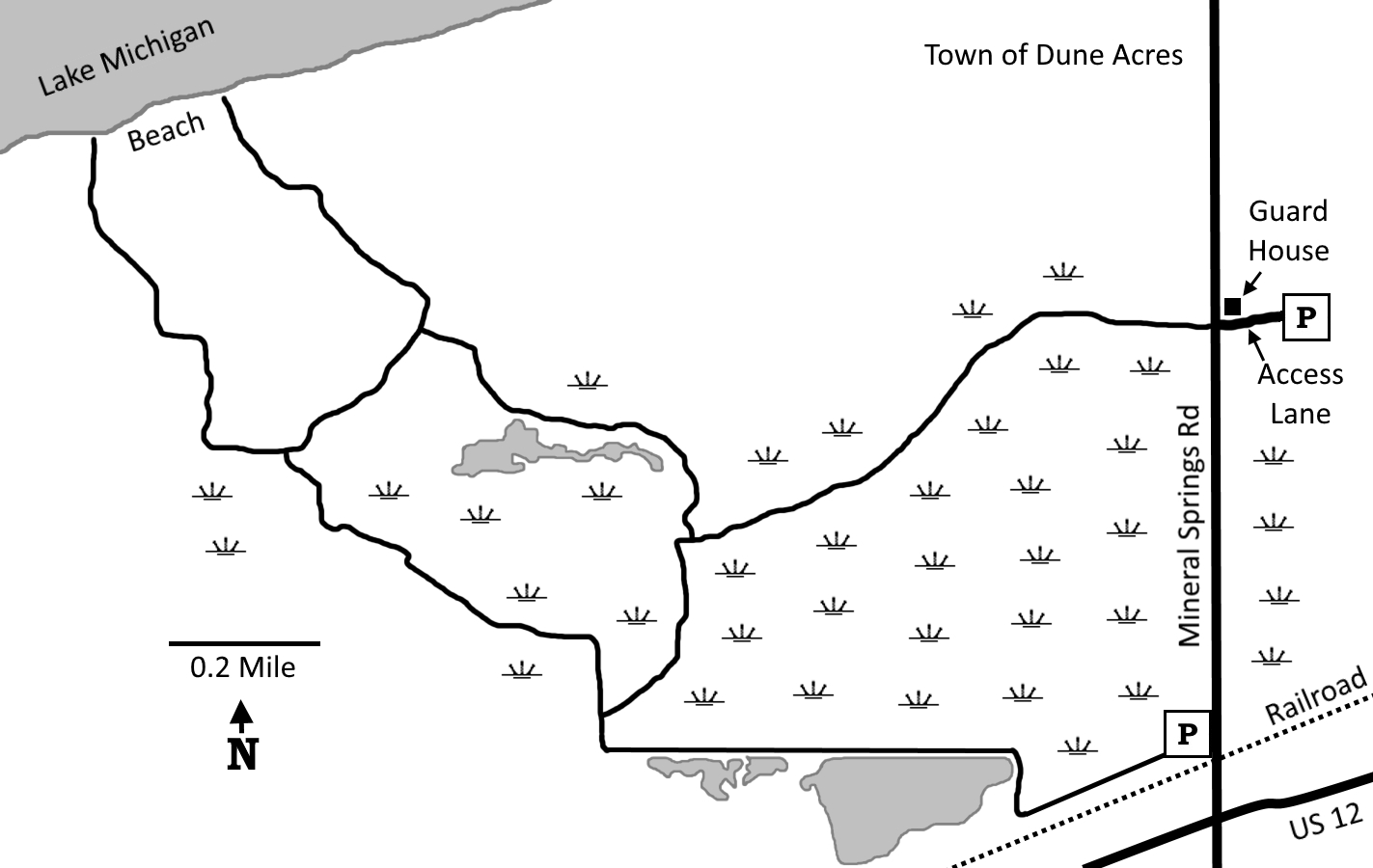
Click to enlarge
Directions
Porter County. From US 12 X IN 49, west 1.4 miles on US 12 to Mineral Springs Rd, then north 0.7 miles, then right onto a dirt lane just before the guard shack. Park at the end of the lane.
GPS: N 41 38.714 W 87 05.087 (north lot)
GPS: N 41 38.212 W 87 05.213 (south lot)
Facilities
Chemical toilet
Finder Sketch
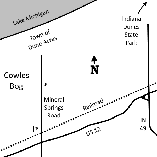
Click to enlarge
Nearby Natural Areas (miles)
Little Calumet River Trail (1.3)
Indiana Dunes State Park (3)
Glenwood Dunes Trail (4.7)
Kemil Beach (6.1)
Tolleston Dunes (6.4)
Great Marsh (6.5)
Coulter Nature Preserve (8.4)
West Beach (8.9)
Meadowbrook Nature Preserve (10.5)
Moraine Nature Preserve (10.6)
Mount Baldy (10.7)
Miller Woods (10.9)
Barker Woods (13.2)
Cressmoor Prairie (14.1)
Bluhm County Park (15.9)
Bur Oak Nature Preserve (17.2)
Ivanhoe South Nature Preserve (18)