
Glenwood Dunes Trail
Natural Areas: Glenwood Dunes Trail
(Formerly Ly-co-ki-we Trail)
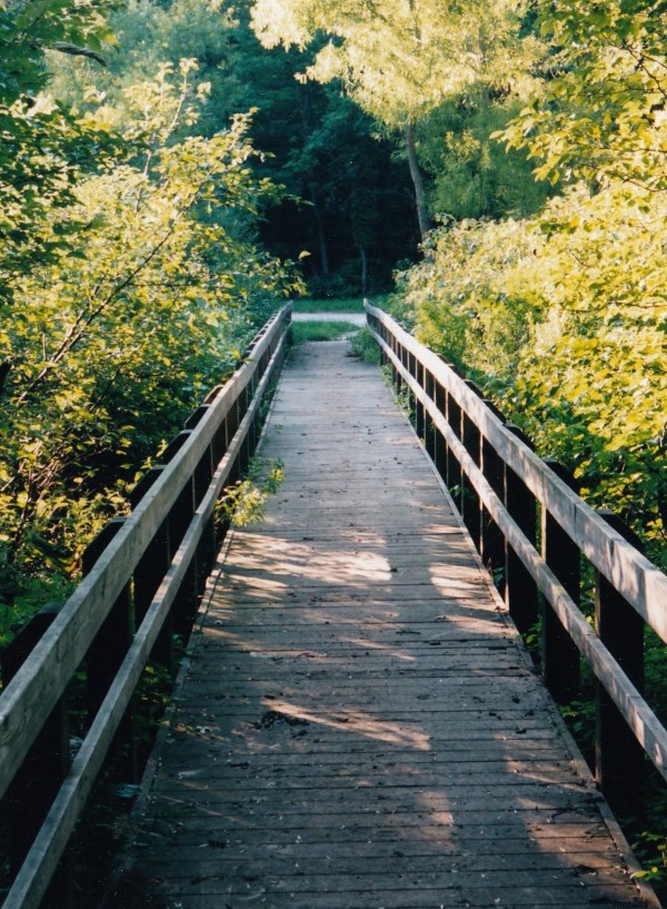
Footbridge. Click to enlarge
Not so much a single trail as a network of trails meandering through recent growth woods, wetlands, and dunes in an area between U.S. 12 and U.S. 20. During the warmer months, much of the trail system is open to horses, with all that entails. Mosquitoes can be fierce, but wildflowers and ferns are common, and the sandy footpath makes for a pleasant if occasionally challenging stroll. In early August, watch for large clusters of Indian pipe (aka corpse plant) near the U.S. 20 entrance. Aside from the trailhead described below, where you can usually find a handout with a map of the trail system, access is available from the Dunewood Campground via the Dunewood Trace (trail).
Directions
Porter County. From the intersection of IN 49 and US 20, proceed east 2.4 miles on US 20 to the parking area on the left (at 275E/Brumitt Road).
GPS: N 41 38.936 W 87 00.871
Facilities
Bathrooms with flush toilets at the U.S. 20 trailhead.
Finder Sketch
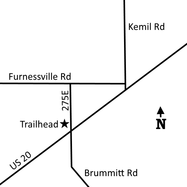
Click to enlarge
Nearby Natural Areas (miles)
Kemil Beach (3.5)
Great Marsh (3.8)
Indiana Dunes State Park (4.2)
Little Calumet River Trail (4.6)
Cowles Bog (4.7)
Mount Baldy (8)
Moraine Nature Preserve (9.2)
Tolleston Dunes (9.9)
Barker Woods (10.1)
Meadowbrook Nature Preserve (11.5)
Coulter Nature Preserve (12.2)
West Beach (12.7)
Bluhm County Park (14.5)
Miller Woods (14.6)
Ambler Flatwoods (15.7)
Wintergreen Woods (17.6)
Cressmoor Prairie (17.9)
Greiner Nature Preserve (20)